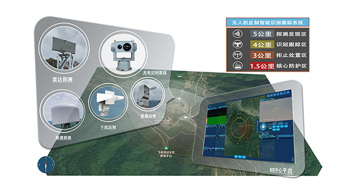
1.3km Navigation Deception
The system features a 360-degree horizontal detection angle for all-around monitoring in the 2.4GHz and 5.8GHz detection frequency bands. It has a detection range of at least 1300 meters.
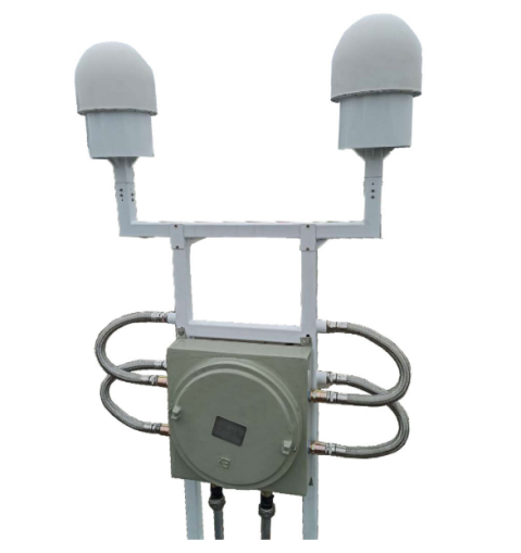
Working Frequency Bands:- 1573.8 to 1576.1 MHz- 1559.6 to 1562.3 MHz- 1599.7 to 1600.5 MHz
Effective Deception Distance: Up to 800 meters (adjustable based on the on-site environment).
Deception Response Time: Less than or equal to 15 seconds.
Deception Quantity: Can deceive a minimum of 5 UAVs simultaneously.
The system employs deceptive signals replicated from at least two satellite navigation frequencies. It interferes with the satellite navigation coordinate information received by UAVs using satellite navigation positioning, enabling functions such as no-fly zone projection or area denial.
No-Fly Zone Projection: By radiating false no-fly zones (e.g., near airports), the system deceives unauthorized UAVs into believing they have entered a restricted area, leading them to initiate forced landing or return to base.
Area Denial: Utilizing strategic trajectory deception signals, the system prevents unauthorized UAVs from entering protected areas by leading them off course.
This technology provides an effective means of countering UAV threats by exploiting their reliance on satellite navigation systems for positioning and control.

Hot line:
400-110-5151
Address:Room 403, Building A, Xin Lihua Information Industrial Park Information Industry Park, No. 49, Nanwan Street, Longgang District, Shenzhen